
Water has shaped nearly every chapter of Madera County’s history. From the rivers and seasonal streams that supported Indigenous communities to the irrigation canals that transformed the Central Valley into one of America’s most productive agricultural regions, access to dependable water has influenced where people settled, what they cultivated, how communities developed, and which industries prospered.
Today, Madera County is widely recognized for its agricultural landscape. Almond orchards, pistachio farms, vineyards, dairy operations, and other agricultural businesses contribute to the local economy and help define the region’s identity. However, the landscape visible along Highway 99 and throughout the surrounding countryside did not develop naturally. It resulted from generations of investment in irrigation infrastructure, groundwater wells, water storage, farming technology, and complicated decisions about how limited water resources should be distributed.
The history of water in Madera County is also a story of challenges. Farmers who depended on groundwater discovered that pumping could exceed natural replenishment. Irrigation districts developed to bring more reliable surface water to agricultural properties, while major federal water projects changed how rivers were managed and delivered water across the Central Valley. Periods of drought repeatedly tested the agricultural economy, demonstrating how vulnerable farms and communities could become when water supplies declined.
In the twenty-first century, these historical challenges remain relevant. Groundwater sustainability, drought preparation, water conservation, agricultural efficiency, and changing climate conditions have become important issues for residents, farmers, local governments, and water agencies.
Understanding how Madera County developed its water systems provides a valuable perspective on the region’s past and its future. The story explains how a landscape that once depended heavily on seasonal water availability became a major agricultural center, and why protecting water resources remains essential to preserving the county’s agricultural heritage.
Water and the Earliest Communities of Madera County
Long before modern irrigation districts, pumping stations, and agricultural canals appeared, water influenced human settlement throughout the region that eventually became Madera County. Rivers, streams, seasonal wetlands, and mountain runoff provided resources that supported Indigenous communities and shaped their relationships with the surrounding environment.
The geography of Madera County creates an important connection between the Sierra Nevada mountains and the Central Valley. Water originates in the higher elevations through precipitation and snow accumulation, then moves through streams, rivers, and underground systems toward lower elevations. This natural movement has influenced settlement, agriculture, wildlife, and economic development for thousands of years.
Indigenous communities understood these seasonal patterns through generations of observation and experience. The region was home to several Native peoples, including Northern Valley Yokuts, Foothill Yokuts, Sierra Miwok, and Monache communities. Their relationships with the land included knowledge of native plants, seasonal food sources, rivers, foothill environments, and mountain resources.
Water was important for more than drinking and household needs. It supported plants used for food and materials, provided habitat for wildlife, and influenced seasonal movement and community activities. Rivers and streams were part of larger cultural landscapes rather than simply sources of water to be diverted toward agricultural properties.
This earlier history deserves recognition because the modern irrigation system represents only one stage in a much longer relationship between people and water in the region.
The historical importance of Indigenous communities is also reflected in surviving cultural landmarks. Madera History’s article about the Wassama Round House and the living Native American heritage of Madera County provides additional context about the region’s Indigenous heritage and the importance of preserving cultural connections to the landscape.
Rivers and Natural Water Sources
The Fresno River became particularly important in the development of the community that eventually grew into the City of Madera. Other regional waterways, including the San Joaquin River and the Chowchilla River, also influenced settlement and agricultural development.
These waterways provided opportunities for early residents to access water without relying on the extensive infrastructure that would later become necessary for commercial agriculture.
However, natural river flows were not always dependable. Water availability changed throughout the year, particularly between the wet winter and spring months and the hot, dry summer season.
The Sierra Nevada snowpack played an especially important role. Snow accumulated at higher elevations during winter and gradually melted as temperatures increased. The resulting runoff contributed to streams and rivers that supplied downstream communities and agricultural areas.
This seasonal pattern created both opportunities and limitations. During periods of abundant precipitation, rivers could carry substantial amounts of water. During dry years, however, natural flows could decline significantly.
For farmers interested in expanding agricultural production, this uncertainty made dependable irrigation increasingly important.
The Beginning of Irrigation Development in Madera County
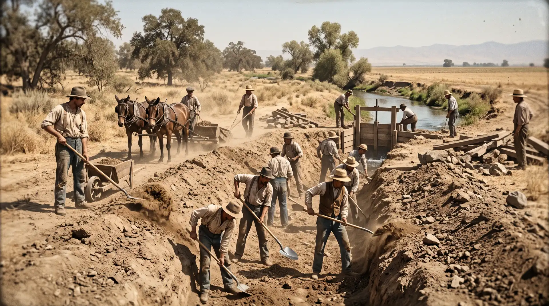
Commercial irrigation development in the Madera region began during the nineteenth century, when agricultural landowners recognized that the area’s long, dry summers limited the potential of farming without additional water.
Early agricultural operations relied on a combination of rainfall, nearby streams, river diversions, and other locally available water sources. These methods could support certain crops and smaller agricultural operations, but they were less suitable for expanding commercial agriculture across large areas.
The development of irrigation systems required more than digging channels. Landowners needed water rights, engineering plans, construction financing, agreements with other water users, and a reliable method of distributing water across agricultural properties.
These requirements made irrigation development a complicated process involving business interests, legal disputes, engineering challenges, and local cooperation.
Isaac Friedlander and Early Fresno River Irrigation
One important figure in the early history of Madera County water development was Isaac Friedlander.
Historical records from the Madera Irrigation District describe how Friedlander obtained water rights on the Fresno River in 1872. His objective was to provide irrigation water to agricultural properties near and southwest of what is now the City of Madera.
His efforts reflected a growing recognition that the region’s agricultural future depended on developing more reliable water supplies.
Friedlander also participated in efforts to move water from other watersheds into the Fresno River system. Historical accounts identify the Big Creek Diversion, which brought water from the Merced River watershed toward the Fresno River watershed.
In 1875, Friedlander and W.S. Chapman also pursued the Soquel Diversion, which involved moving water from the San Joaquin River watershed toward the Fresno River watershed.
These projects demonstrated the ambitious nature of early water development in the region. Rather than depending exclusively on the nearest natural waterway, agricultural interests were beginning to consider larger systems capable of connecting different sources with agricultural demand.
The early diversions helped establish an important principle that would continue to influence Madera County water history: the future of agriculture depended on organizing water resources across a much larger geographic area.
The Madera Canal and Irrigation Company
The development of a larger irrigation system became a major objective during the late nineteenth century.
In 1888, the Madera Canal and Irrigation Company was organized as a successor to earlier water development efforts associated with Friedlander, Chapman, and other interests.
The proposed organization covered approximately 280,000 acres and envisioned a substantial irrigation network capable of supporting agricultural development across the region.
One of its major ambitions was to obtain a dependable water supply through construction of a dam on the San Joaquin River near the location that would later become associated with Friant Dam.
However, the proposal encountered serious legal and financial difficulties.
Downstream water users and major landowners opposed aspects of the project, creating disputes over water rights and the distribution of river resources. These disagreements made it difficult to secure the necessary agreements and financing.
The company eventually dissolved in 1896.
Although the original plan did not succeed, its history demonstrated how important water infrastructure had become to regional development. It also revealed the conflicts that could emerge when multiple communities, landowners, and agricultural interests depended on the same river system.
The early Madera irrigation proposals established the foundation for later efforts to create a more organized and dependable water distribution system.
The Formation of Madera Irrigation District
The failure of the nineteenth-century irrigation company did not end efforts to establish a dependable water supply. As agricultural development continued, farmers and landowners increasingly recognized that a coordinated irrigation system was necessary to support long-term economic growth.
The next major chapter began during the early twentieth century.
In 1920, the Madera Irrigation District was established following efforts by local residents and agricultural interests to develop a more reliable water supply. A committee of approximately 40 members helped organize the effort, reflecting the importance that local landowners placed on irrigation infrastructure.
The original district covered approximately 352,000 acres. Its organizers envisioned a large water development project connected to the San Joaquin River and a distribution network that could deliver water to agricultural properties.
The project faced many of the same challenges encountered by earlier irrigation proposals. Water rights disputes, financial limitations, and opposition from downstream interests complicated development. In particular, litigation involving Miller & Lux, a major landholding and agricultural enterprise in the Central Valley, created significant obstacles.
The original district eventually reduced its boundaries after years of unsuccessful negotiations and legal challenges. Its service area became substantially smaller, but the effort to develop dependable irrigation continued.
This history illustrates an important characteristic of California water development. Major infrastructure projects rarely emerged from engineering decisions alone. They depended on legal agreements, public financing, government participation, and negotiations between people with competing interests.
Why Farmers Needed an Organized Irrigation District
Before dependable surface water became available, farmers often had to rely on private wells. Although groundwater supported agricultural expansion, pumping created long-term problems when withdrawals exceeded natural replenishment.
Individual landowners could install wells and purchase pumping equipment, but the costs were substantial. Deeper wells, larger pumps, fuel, maintenance, and electricity created additional financial burdens.
An irrigation district offered a different approach. Instead of requiring every farmer to develop an independent water supply, the district could organize the acquisition, transportation, and distribution of water through shared infrastructure.
This arrangement could provide several advantages:
-
A more dependable source of agricultural water.
-
Shared infrastructure and maintenance responsibilities.
-
Greater opportunities for long-term agricultural investment.
-
Improved access to water for properties located farther from natural waterways.
-
A more coordinated approach to managing regional water supplies.
The creation of the district represented an important turning point in Madera County history. It established an institutional structure that would eventually become central to the county’s agricultural development.
Groundwater Pumping and the Early Agricultural Boom
While local leaders pursued large irrigation projects, groundwater became increasingly important to farmers throughout Madera County.
Groundwater is water stored beneath the Earth’s surface in soil, sand, gravel, and other geological formations. In the Central Valley, underground aquifers have historically provided an important source of water for agriculture, residential communities, and commercial activities.
Farmers discovered that wells could provide water even when rivers and streams were carrying limited amounts of water. This made groundwater particularly valuable during the hot summer months, when crops needed irrigation but rainfall was scarce.
The availability of groundwater helped expand agricultural production, particularly during periods when surface water infrastructure was incomplete.
However, the ability to pump water did not necessarily mean that the resource was unlimited.
The Problem of Groundwater Overdraft
Groundwater overdraft occurs when more water is pumped from an aquifer over an extended period than is replenished through natural processes and managed recharge.
When withdrawals exceed replenishment, groundwater levels decline. Wells may need to be deepened, pumping costs increase, and some existing wells may eventually become unreliable.
This problem became increasingly serious in Madera County during the early twentieth century.
Farmers expanded agricultural acreage while waiting for more dependable surface water supplies. As a result, groundwater pumping increased substantially.
Historical research discussed in the Madera Irrigation District’s centennial history book describes the scale of the problem. A historical state engineering estimate cited in that book indicated that between 1921 and 1929, the area experienced average annual groundwater withdrawals exceeding replenishment by approximately 61,000 acre-feet.
An acre-foot represents the volume of water required to cover one acre of land with one foot of water. It is a standard measurement used throughout the western United States for agricultural and municipal water planning.
The historical estimate demonstrated that groundwater was being consumed faster than the underground supply could recover.
The problem affected more than agricultural production. It also created financial concerns for farmers who depended on groundwater.
According to the district’s historical account, the Federal Land Bank expressed concern about lending money to Madera County farmers because of the area’s groundwater overdraft and lack of dependable supplemental water supplies.
This situation demonstrates how water availability can influence the financial structure of an entire agricultural region. A farm may have productive soil, modern equipment, and access to transportation, but without a reliable water supply, its long-term economic prospects become uncertain.
The Importance of Surface Water Development
The groundwater problems experienced during the early twentieth century strengthened the argument for developing large surface water projects.
Surface water could supplement groundwater pumping and reduce the pressure placed on underground aquifers. However, transporting river water required major investments in dams, canals, reservoirs, distribution channels, and related infrastructure.
The development of dependable surface water supplies would eventually transform Madera County agriculture.
It also established the foundation for a more complicated relationship between surface water and groundwater. Rather than treating the two sources as completely separate resources, modern water management increasingly recognizes that they are connected components of the same regional water system.
Friant Dam and the Central Valley Project Transform Madera Agriculture
One of the most significant developments in California water history was the creation of the Central Valley Project, a massive federal water infrastructure program designed to manage and distribute water throughout California’s Central Valley.
The project changed agricultural development across the region, including Madera County.
The San Joaquin River became central to the effort. Its water could be captured, stored, and transported through a network of reservoirs and canals serving agricultural districts and communities.
The construction of Friant Dam was particularly important to Madera’s agricultural future.
Construction of Friant Dam
Friant Dam is located on the San Joaquin River northeast of Fresno. Construction began in 1939 as part of the federal Central Valley Project.
The dam was completed in 1944, although the development of associated water delivery infrastructure continued after its completion.
The reservoir created by Friant Dam became known as Millerton Lake.
The project made it possible to store water from the San Joaquin River and release it through an engineered distribution network. This helped address the seasonal differences between water availability in the Sierra Nevada and agricultural demand in the Central Valley.
During the winter and spring, precipitation and snowmelt contribute to river flows. During the summer, agricultural demand increases as temperatures rise and rainfall becomes limited.
Storage infrastructure helps manage these seasonal differences by retaining water when it is available and distributing it when needed, subject to water rights, operating requirements, and available supplies.
The Madera Canal
The Madera Canal, also known as the Friant-Madera Canal, became one of the most important pieces of infrastructure serving the county.
The canal transports water from Friant Dam toward Madera County, providing an essential connection between the San Joaquin River and agricultural distribution systems.
The main canal extends approximately 36 miles. Its construction began during the early 1940s, and water deliveries developed gradually during the following years.
World War II slowed construction, while additional distribution infrastructure and disagreements over federal reclamation requirements also affected the project’s development.
By approximately 1950, the canal had reached its intended capacity.
The Madera Canal was designed primarily as a bulk conveyance facility. This means it transports water from the main source toward the service area, while local irrigation districts and distribution systems handle delivery to individual agricultural properties.
The distinction is important because a major canal does not automatically provide water to every farm. Additional infrastructure is needed to move water from the main canal into smaller distribution channels, pipelines, and agricultural delivery points.
The historical significance of the canal is difficult to overstate. It provided an important surface water supply that helped reduce dependence on groundwater and supported the expansion of commercial agriculture.
Today, the Madera Irrigation District reports operating approximately 300 miles of open-flow canals and 150 miles of large-diameter pipelines across its service area of approximately 140,000 acres. These figures illustrate the scale of the distribution system that developed around the county’s irrigation infrastructure.
Millerton Lake and Agricultural Water Storage
Millerton Lake is more than a recreational destination. It is an important component of the water management system supporting agricultural and municipal uses in the region.
The reservoir stores water behind Friant Dam and allows releases to be coordinated with downstream requirements.
For Madera County farmers, the connection between Millerton Lake and the Madera Canal represents a major improvement over depending entirely on individual wells or nearby seasonal waterways.
However, reservoir storage does not eliminate drought risk. During extended periods of low precipitation and limited snowpack, the amount of water available for storage and distribution can decline.
Water deliveries may also be affected by contractual arrangements, environmental requirements, hydrological conditions, and other operational considerations.
The development of Millerton Lake and the Madera Canal therefore represents an important achievement, but not a guarantee of unlimited agricultural water.
The Growth of Irrigation Infrastructure Across Madera County
The arrival of more dependable surface water encouraged the development of additional irrigation infrastructure throughout the region.
Canals, laterals, pipelines, control structures, diversion facilities, and pumping equipment became essential parts of the agricultural landscape.
These facilities helped connect the main water delivery systems with individual farms and agricultural properties.
Open Canals and Gravity-Fed Water Distribution
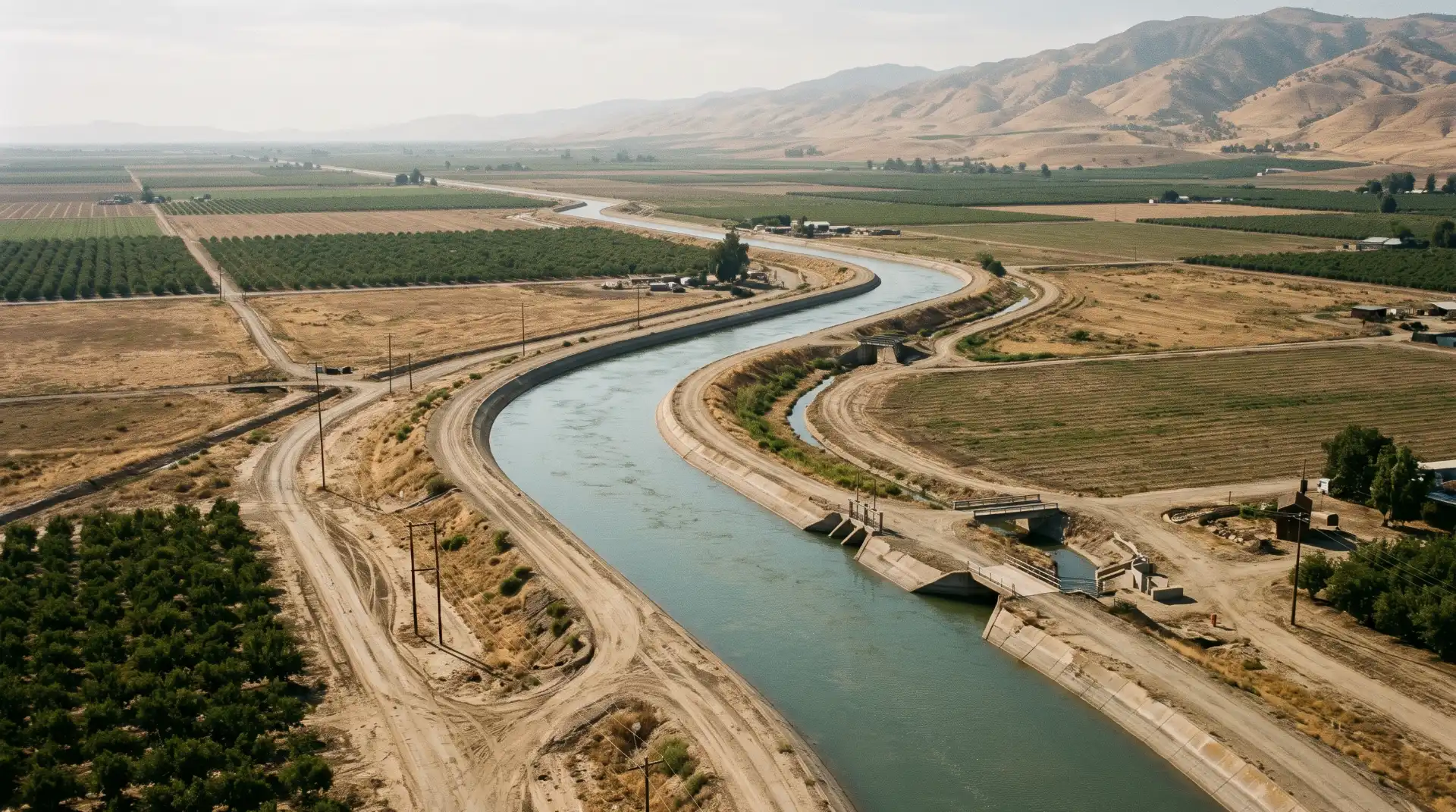
One of the most recognizable features of Madera County’s irrigation infrastructure is its network of open canals.
Many irrigation canals operate using gravity. Water moves through channels designed with carefully controlled elevations and slopes, allowing it to travel across the landscape without requiring continuous mechanical pumping.
Gravity-fed systems can be more energy-efficient than systems that depend entirely on pumping water uphill.
However, they still require substantial engineering and maintenance. Canal operators must monitor water levels, manage gates, remove accumulated sediment, inspect structures, and maintain the channels to support dependable deliveries.
The network also requires careful scheduling because agricultural water demand varies throughout the growing season.
During warmer months, orchards and other crops may require frequent irrigation. During cooler periods, demand may decline, although certain crops still need carefully managed water applications.
The Role of the Chowchilla Water District
The development of irrigation infrastructure was not limited to the Madera Irrigation District.
The Chowchilla region experienced its own water challenges.
According to the Chowchilla Water District’s historical account, irrigation in the area began during the late nineteenth century with artesian wells.
Artesian wells draw water from underground formations where natural pressure allows water to rise within the well. Historically, they offered an important source of water for agricultural operations.
However, by the 1940s, declining groundwater supplies threatened the economic future of the region.
The Chowchilla Water District was established in 1949 to provide supplemental agricultural water. At the time, the area had been part of the Madera Irrigation District.
In 1950, the district signed its original water service contract with the federal government for water from the Friant Division of the Central Valley Project. A second contract followed in 1968 for water associated with the Buchanan Unit.
In 1988, the LaBranza Water District and Chowchilla Water District consolidated into the current Chowchilla Water District.
The district now serves more than 400 landowners across approximately 85,000 acres in southern Merced County and northern Madera County.
Its history provides another example of how declining groundwater supplies encouraged agricultural communities to organize around more dependable surface water sources.
How Irrigation Changed Agricultural Land Use
Reliable irrigation changed what farmers could grow and how they could manage their properties.
Before dependable irrigation became widely available, agricultural production was more closely influenced by natural rainfall and the availability of nearby water sources.
Farmers were more limited in their ability to establish permanent crops across large areas.
As irrigation infrastructure expanded, agricultural land became increasingly suitable for crops that required consistent water management over many years.
This helped create the conditions for the growth of vineyards, orchards, and other permanent agricultural operations.
The connection between water infrastructure and crop development is explored further in Madera History’s article, Madera County’s Agricultural History: How Farming Built the Community.
The expansion of irrigation also supported local businesses. Agricultural equipment suppliers, irrigation contractors, farm labor operations, transportation companies, food processors, and financial institutions benefited from the growth of commercial farming.
In this way, water infrastructure helped create an agricultural economy that extended far beyond individual farms.
How Irrigation Helped Build Madera County’s Orchard Economy
The development of irrigation systems made it increasingly practical for farmers to establish permanent crops across portions of the Central Valley.
These crops require long-term investment because trees and vines may take several growing seasons to become commercially productive.
A farmer establishing an orchard must consider water availability not only for the current season but also for many years into the future.
This is especially important because mature trees cannot simply be left without irrigation during a drought without potentially suffering serious damage.
Almond Orchards and the Need for Reliable Water
Almond production became one of the defining features of modern Madera County agriculture.
Almond trees require carefully managed irrigation throughout important stages of development. Water availability influences tree growth, crop production, and long-term orchard health.
Growers must also consider soil conditions, drainage, irrigation timing, weather patterns, and the amount of water available through surface deliveries and groundwater pumping.
The expansion of almond production during the twentieth century demonstrates how irrigation infrastructure influenced agricultural decisions.
Once farmers gained greater confidence in their ability to obtain water, investing in permanent orchards became more attractive.
Pistachios, Grapes, and Agricultural Diversification
Pistachios and grapes also became important parts of Madera County’s agricultural economy.
Different crops have different irrigation requirements, growing seasons, soil preferences, and economic characteristics.
Farmers therefore consider water availability when deciding which crops to plant.
A vineyard, for example, requires irrigation management that supports healthy vines and appropriate fruit development. Pistachio orchards also require carefully managed water throughout their production cycle.
The development of these agricultural industries reflects a combination of water infrastructure, market opportunities, agricultural research, and generational farming knowledge.
Madera County’s fruit and nut industry has evolved considerably over time. The article Madera County’s Fruit and Nut Industry: How Orchards Became a Central Valley Tradition provides additional background about how permanent crops transformed the county’s agricultural landscape.
Irrigation and the Growth of Agricultural Communities
Agricultural water development influenced the growth of communities throughout the county.
When farms became more productive, they required additional workers, equipment, transportation, processing facilities, and commercial services.
Small businesses developed to support farmers, while agricultural employment contributed to population growth and local economic activity.
Water infrastructure also influenced land values. Properties with dependable access to irrigation water could offer different agricultural opportunities from properties that relied exclusively on uncertain groundwater supplies.
The expansion of irrigation therefore affected not only crop production but also the economic geography of Madera County.
Droughts and Their Impact on Madera County Agriculture
Although irrigation infrastructure improved agricultural water reliability, Madera County has never been completely protected from drought.
California’s Mediterranean climate creates a natural pattern of wet winters and dry summers. Agricultural production depends heavily on the amount of precipitation received during the winter months, the condition of the Sierra Nevada snowpack, and the availability of water stored in reservoirs and underground aquifers.
When precipitation declines for several consecutive years, the consequences can extend throughout the agricultural economy.
Farmers may receive less surface water, increase groundwater pumping, postpone planting decisions, remove orchards, or invest in additional irrigation equipment.
The effects can also extend beyond farms to rural households, businesses, agricultural workers, and communities that depend on private wells.
The Historic 2012–2016 California Drought
One of the most significant modern drought periods affecting California occurred between 2012 and 2016.
The drought placed substantial pressure on water supplies throughout the Central Valley. Reservoir levels declined, snowpack conditions became a major concern, and agricultural water users faced difficult decisions about managing limited supplies.
Madera County experienced challenges associated with reduced surface water availability and continued groundwater demand.
For farmers with access to surface water, reduced deliveries could mean greater dependence on wells. For growers relying primarily on groundwater, prolonged dry conditions could increase pumping expenses and contribute to declining aquifer levels.
Permanent crops created additional difficulties.
An annual crop can sometimes be left unplanted during a particularly dry year. An established almond or pistachio orchard represents a long-term investment that may require continued irrigation even when water supplies are limited.
Removing an orchard can involve substantial financial losses because growers must consider the value of established trees, previous investment costs, removal expenses, and the time required for replacement plantings to become productive.
The drought demonstrated that water planning must consider long-term agricultural commitments rather than only immediate seasonal demand.
The Relationship Between Snowpack and Agricultural Water
Madera County’s agricultural water supply is closely connected to precipitation in the Sierra Nevada.
Snowpack functions as a natural water storage system. Snow accumulates during colder months and releases water as temperatures rise in the spring and early summer.
This gradual release contributes to river flows and reservoir supplies.
When winter temperatures are warmer, precipitation may fall as rain instead of snow at certain elevations. Snowmelt can also occur earlier, changing the timing of water availability.
These changes can complicate water management because agricultural demand is often highest during the summer, when natural precipitation is limited.
A season with substantial rainfall does not necessarily guarantee dependable summer irrigation supplies. Water storage, reservoir operations, snowpack conditions, and groundwater availability all influence the amount of water that can be delivered.
This distinction is important when evaluating drought conditions. Water managers must consider not only how much precipitation falls but also when it falls, where it accumulates, and how much can be stored for later use.
The Effects of Drought on Rural Households
Agricultural districts are not the only communities affected by declining water supplies.
Many residents in rural portions of Madera County depend on private domestic wells.
When groundwater levels decline, shallow wells may become vulnerable to reduced production or failure.
The problem can be especially serious in communities where residents have limited financial resources to deepen or replace wells.
Unlike a large agricultural operation, an individual household may not have the financial ability to respond quickly to a water shortage.
Madera County’s October 2024 Drought and Water Shortage Risk Analysis and Response Plan specifically examines the vulnerability of small water systems and self-supplied rural communities. The document identifies groundwater dependence, drought exposure, domestic wells, and emergency drinking water solutions as important planning considerations.
It also recognizes the need for monitoring, coordination, and longer-term improvements to water system reliability.
The experience of rural residents illustrates why water management should be considered a community issue rather than exclusively an agricultural concern.
Groundwater Sustainability and California’s SGMA Law
The history of groundwater overdraft eventually led California to develop a new statewide approach to groundwater management.
For much of the twentieth century, groundwater pumping in California was not subject to the same comprehensive statewide management framework that applied to certain surface water resources.
Local groundwater management practices varied considerably, and agricultural development in some regions depended heavily on pumping.
As groundwater levels declined in parts of the Central Valley, the need for more organized management became increasingly apparent.
In 2014, California adopted the Sustainable Groundwater Management Act, commonly known as SGMA.
The legislation created a framework for managing groundwater basins through local agencies called Groundwater Sustainability Agencies, or GSAs.
These agencies are responsible for developing and implementing Groundwater Sustainability Plans, which establish strategies for avoiding undesirable groundwater conditions and achieving long-term sustainability.
Why SGMA Matters to Madera County
Madera County contains portions of three groundwater subbasins identified by the California Department of Water Resources as high-priority and critically overdrafted:
-
The Chowchilla Subbasin.
-
The Madera Subbasin.
-
A portion of the Delta-Mendota Subbasin.
The local groundwater sustainability plans established a framework intended to achieve sustainability by 2040.
Multiple agencies participate in groundwater management across these areas. Their responsibilities reflect the fact that groundwater basins do not necessarily follow city boundaries, irrigation district boundaries, or individual property lines.
The Madera Subbasin, for example, includes several groundwater sustainability agencies, including Madera County, the City of Madera, Madera Irrigation District, Root Creek Water District, Madera Water District, New Stone Water District, and Gravelly Ford Water District.
The Chowchilla Subbasin also involves multiple agencies and crosses county boundaries.
This arrangement requires cooperation between agricultural districts, local governments, water agencies, and other groundwater users.
Readers interested in the official local planning structure can consult the Madera County Water and Natural Resources Department’s groundwater subbasin information.
What Does Groundwater Sustainability Mean?
Groundwater sustainability does not necessarily mean that every property must stop pumping water.
Instead, the objective is to manage groundwater withdrawals, replenishment, and related conditions so that the basin can continue supporting beneficial uses over the long term.
Groundwater Sustainability Plans examine several important issues, including declining groundwater levels, land subsidence, water quality, interconnected surface water, and other undesirable results.
One major concern is land subsidence.
When groundwater is removed from certain underground formations, the pressure supporting layers of sediment can decline. In some circumstances, the sediment compresses, causing the ground surface to sink.
This process can damage infrastructure and reduce the ability of an aquifer system to store water in the future.
Groundwater quality is another important consideration. Changes in groundwater levels and pumping patterns can affect water quality conditions, depending on local geology and other environmental factors.
Sustainable management therefore requires more than simply counting the number of wells or estimating annual pumping. It involves understanding the entire groundwater system and the effects that water use has on the surrounding environment.
Groundwater Allocations and Agricultural Planning
Groundwater management can influence how farmers make decisions about their properties.
As local sustainability programs develop, agricultural landowners may face allocation rules, reporting requirements, pumping restrictions, or other management measures.
These policies can affect the economics of crop production.
A grower planning to establish a new orchard must consider whether sufficient water will be available throughout the orchard’s productive life.
The same consideration applies to existing farms deciding whether to replant aging trees, change crops, install new irrigation systems, or reduce agricultural acreage.
Madera County’s groundwater management framework has continued to evolve. Its published resolutions include groundwater allocation measures and more recent policies addressing allocation amounts for the 2026–2040 period.
This demonstrates that the historical problem of groundwater overdraft remains an active issue requiring ongoing management rather than a challenge that was solved when surface water infrastructure was constructed.
Modern Irrigation Technology and Water Conservation
Madera County’s irrigation systems have changed considerably since the first agricultural canals were developed.
Modern farmers have access to equipment and information that allow them to manage water more precisely.
Although traditional flood irrigation and open-channel distribution remain part of the region’s agricultural history, newer systems provide additional opportunities to improve efficiency.
Drip Irrigation and Micro-Irrigation
Drip irrigation delivers water through small emitters positioned near plant roots.
Instead of distributing water across an entire field, the system applies water closer to the areas where crops can use it.
This approach can help reduce unnecessary water applications, particularly when systems are properly designed and maintained.
Micro-sprinkler systems are also used in orchards. They distribute water over a limited area around trees, providing an alternative to traditional irrigation methods.
The most appropriate system depends on soil conditions, crop type, water quality, equipment costs, and farm management objectives.
Soil Moisture Monitoring
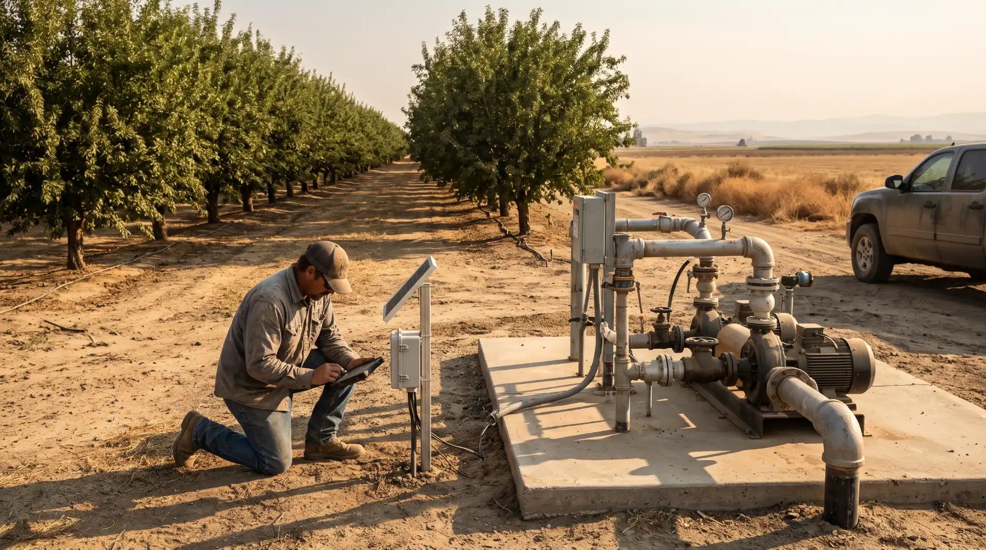
Farmers increasingly use soil moisture sensors to determine how much water is available within the root zone.
These instruments provide information about soil conditions at different depths and can help growers decide when irrigation is necessary.
Without monitoring, farmers may apply water according to fixed schedules that do not accurately reflect actual crop requirements.
Soil moisture information can support more informed irrigation decisions, especially when combined with weather data and knowledge of crop development.
Weather-Based Irrigation Scheduling
Weather conditions influence how quickly crops lose water through evaporation and plant transpiration.
This combined process is known as evapotranspiration.
Farmers and agricultural advisers use evapotranspiration estimates to help determine crop water requirements.
Weather stations, regional agricultural information systems, and crop-specific guidelines can help growers adjust irrigation schedules as temperatures and environmental conditions change.
This is particularly useful in Madera County, where summer temperatures can become extremely high and agricultural water demand can increase rapidly.
The Role of Agricultural Research
University research and local agricultural education also contribute to improved water management.
UC Cooperative Extension provides information and educational resources for California farmers, including research related to irrigation management, crop production, soil conditions, and agricultural sustainability.
These programs help connect scientific research with the practical decisions farmers make every day.
The combination of modern technology and generational agricultural experience is increasingly important as Madera County works to balance agricultural productivity with groundwater sustainability.
Water Recharge and the Future of Madera County
One of the most important developments in modern water management is the growing recognition that groundwater must be replenished as well as conserved.
Groundwater recharge occurs when water moves downward through soil and other permeable materials and eventually reaches underground aquifers.
Natural recharge can occur through rainfall, river flows, streambeds, and other processes. However, agricultural and water management practices can also create opportunities to increase recharge under suitable conditions.
Floodwater and Managed Aquifer Recharge
Managed aquifer recharge involves intentionally directing available water toward locations where it can infiltrate into the ground and replenish groundwater supplies.
During periods of heavy precipitation, some agricultural properties may be suitable for receiving additional water under carefully managed conditions.
Flood-managed recharge can be particularly interesting in the Central Valley because agricultural land provides opportunities to capture and infiltrate water when supplies are available.
However, not every property is suitable for this practice. Soil permeability, groundwater depth, crop type, water quality, infrastructure, and environmental considerations all influence whether recharge can be conducted successfully.
Almond orchards and other agricultural properties may be considered for certain recharge approaches, but growers must evaluate the effects of prolonged water application on tree health and soil conditions.
Managed recharge is not a replacement for responsible groundwater management. It is one potential component of a larger strategy involving conservation, surface water planning, monitoring, and demand management.
The Importance of Coordinated Water Management
Madera County’s groundwater basins extend across multiple jurisdictions and include different categories of water users.
A groundwater management strategy that works for one agricultural district may not be appropriate for every community or property.
Some farmers have access to irrigation district surface water, while others depend heavily on groundwater. Rural households may rely on individual domestic wells, and municipalities must maintain dependable drinking water supplies.
These different needs make coordination essential.
Local agencies must consider how agricultural pumping, urban demand, surface water deliveries, groundwater recharge, and environmental requirements interact.
Public participation is also important. Residents, farmers, property owners, and community organizations can benefit from understanding proposed groundwater policies and participating in local planning discussions.
The long-term success of groundwater management will depend partly on whether these different groups can work together toward realistic and measurable sustainability goals.
How Water Availability Will Shape Madera County Agriculture
Water will continue to influence agricultural decisions throughout Madera County.
The region’s established orchards, vineyards, dairy operations, and other agricultural businesses depend on reliable water supplies. At the same time, groundwater management requirements and changing environmental conditions are creating new considerations for farmers.
Future agricultural development will likely involve a greater emphasis on water availability, irrigation efficiency, and long-term resource planning.
Choosing Crops Based on Water Availability
Farmers traditionally evaluate crops based on soil quality, market opportunities, climate, labor requirements, and expected profitability.
Water availability is becoming an increasingly important part of that decision-making process.
A crop that appears profitable under favorable water conditions may become financially risky if irrigation supplies decline or pumping costs increase.
Permanent crops require particularly careful planning because growers cannot easily change production from one year to the next.
Before establishing an orchard, agricultural operators should consider the reliability of their surface water supply, groundwater conditions, irrigation infrastructure, and the financial implications of possible water shortages.
These considerations are important not only for large commercial farms but also for smaller family-operated agricultural properties.
Agricultural Land and Changing Water Conditions
Changes in water availability may influence which properties remain economically suitable for certain types of agriculture.
Some landowners may invest in more efficient irrigation systems, while others may decide to transition toward different crops or reduce production.
In areas where groundwater supplies become increasingly limited, agricultural land use may need to change.
These decisions can have consequences for employment, local businesses, property values, and the communities that depend on farming.
The transformation may not happen everywhere at the same rate. Different areas of Madera County have different water sources, soils, agricultural operations, and infrastructure.
Nevertheless, water availability will remain one of the most important factors shaping the county’s agricultural future.
Climate Conditions and Long-Term Water Planning
Climate change adds another layer of uncertainty to water management.
Changes in temperature, precipitation patterns, snowpack, and extreme weather conditions can affect the timing and availability of water.
Higher temperatures can increase agricultural water demand, while changes in Sierra Nevada snow accumulation and melting patterns may influence reservoir operations and downstream river flows.
Planning for these conditions requires long-term thinking.
Water agencies must evaluate infrastructure needs, groundwater conditions, storage opportunities, and potential shortages over multiple decades.
Farmers must also consider how their investments will perform under changing environmental and economic conditions.
Madera County’s history demonstrates that agricultural communities have always adapted to new circumstances. The challenge today is ensuring that adaptation does not come at the expense of the water resources needed by future generations.
Preserving the History of Water in Madera County
Water infrastructure is often viewed as ordinary public works rather than an important part of local history.
However, irrigation canals, diversion structures, pumping stations, reservoirs, agricultural wells, and historic farm equipment tell an important story about how Madera County developed.
These features represent generations of engineering, agricultural investment, political decisions, and community cooperation.
Preserving the history of water development can help future generations understand how the county became an important agricultural region.
Historic Irrigation Canals as Cultural Landscapes
Older irrigation canals provide physical evidence of the transformation that occurred throughout the Central Valley.
Some channels were developed during earlier agricultural periods, while others became part of larger twentieth-century water projects.
Their construction required engineering knowledge, labor, financing, and cooperation among different landowners and organizations.
Historic canals can therefore be studied as part of the county’s industrial and agricultural heritage.
Researchers interested in local history can examine old maps, engineering drawings, photographs, irrigation district records, newspapers, and agricultural reports to understand how these systems developed.
Changes in canal routes and distribution networks can also reveal how agricultural communities expanded over time.
Preserving Family Farming Records
Families who have operated farms in Madera County for generations may possess valuable historical materials.
These records can include:
-
Historic photographs of farms, canals, wells, and irrigation equipment.
-
Agricultural account books and water delivery records.
-
Letters discussing farming conditions and water shortages.
-
Maps showing older property boundaries and irrigation channels.
-
Documents related to water rights and agricultural development.
-
Photographs of family members working in orchards and vineyards.
Such materials can provide details that may not appear in official government records.
For example, an old photograph of a farm irrigation system might reveal how water was distributed before modern pipelines became common. A collection of family letters could describe how drought affected agricultural production during a particular decade.
Oral histories are equally valuable. Interviews with longtime farmers, irrigation workers, district employees, and rural residents can preserve experiences that might otherwise disappear as older generations pass away.
Water History and Local Education
Madera County’s water history also offers opportunities for educational programs.
Schools, historical organizations, libraries, and community groups can use irrigation history to explain the relationship between geography, engineering, agriculture, economics, and environmental management.
Students can explore how the Sierra Nevada supplies water to the Central Valley, why reservoirs are necessary, and how groundwater pumping affects underground aquifers.
Historical comparisons can also help explain why modern water management laws were developed.
The subject connects local history with broader questions about California’s development and the challenges faced by agricultural regions throughout the American West.
Practical Lessons From Madera County’s Water History
The history of Madera County offers several important lessons about water use and agricultural development.
First, access to water can transform an entire region. The development of irrigation infrastructure allowed agricultural production to expand beyond the limitations imposed by seasonal rainfall.
Second, groundwater should not be treated as an unlimited resource. The early twentieth-century overdraft problem demonstrated how quickly agricultural expansion can place pressure on underground water supplies.
Third, major water projects require cooperation. The development of irrigation districts, reservoirs, and canals depended on agreements between local organizations, landowners, state agencies, and the federal government.
Fourth, drought planning must consider both agriculture and residential communities. Farms need dependable irrigation, but rural households also require safe and reliable drinking water.
Finally, historical records are important for understanding modern challenges. The problems facing today’s water managers are connected to decisions made many decades ago.
For residents and property owners interested in understanding local water conditions, several practical steps can be helpful.
Understand the local water source. Property owners should determine whether their water comes from a municipal system, irrigation district, community water provider, or private well. Different sources have different management arrangements and potential vulnerabilities.
Monitor groundwater conditions. Domestic well owners should pay attention to well performance and local groundwater information. Changes in pumping conditions, neighboring wells, and groundwater levels may provide useful warning signs.
Use irrigation efficiently. Agricultural operators can evaluate soil moisture, irrigation scheduling, equipment maintenance, and crop water requirements to identify opportunities for more efficient water use.
Follow local water planning decisions. Madera County residents can review groundwater sustainability plans, attend public meetings, and follow announcements from local water agencies.
Preserve historical information. Old farm photographs, water records, maps, and personal stories can contribute to a better understanding of the county’s agricultural heritage.
These practices connect the lessons of the past with the decisions that will shape Madera County’s future.
Conclusion: Water Remains at the Center of Madera County History
The history of water in Madera County is a story of ambition, engineering, agricultural growth, environmental challenges, and community adaptation.
During the nineteenth century, early settlers and agricultural interests began developing ways to divert water from nearby rivers and streams. Figures such as Isaac Friedlander helped establish some of the earliest irrigation efforts, while the Madera Canal and Irrigation Company demonstrated the growing ambition to create a large regional water system.
The establishment of the Madera Irrigation District in 1920 marked another important stage in the development of organized water management. However, delays in major infrastructure projects contributed to groundwater dependence and early overdraft conditions.
The construction of Friant Dam and the development of the Madera Canal eventually changed the region’s agricultural possibilities. More dependable surface water supplies supported irrigation expansion, reduced some pressure on groundwater, and helped establish the infrastructure needed for large-scale commercial agriculture.
The development of the Chowchilla Water District further demonstrated how local communities responded to declining groundwater supplies by organizing around supplemental surface water resources.
Over time, irrigation helped support the growth of almond orchards, pistachio farms, vineyards, and other agricultural businesses. These operations influenced employment, transportation, local businesses, and the development of communities throughout the county.
Yet the history also contains important warnings. Groundwater overdraft, prolonged droughts, declining well reliability, and changing environmental conditions demonstrate that water development must be accompanied by responsible long-term management.
California’s Sustainable Groundwater Management Act has introduced a new framework for addressing these challenges, while local groundwater sustainability agencies continue working toward long-term basin management.
The future of Madera County agriculture will depend on how successfully communities balance agricultural production, residential needs, groundwater replenishment, and changing water conditions.
For Madera County residents, farmers, and anyone interested in California’s Central Valley history, water is more than a natural resource. It is one of the most important forces that shaped the region’s economy, communities, and identity.
The irrigation canals that cross the agricultural landscape, the reservoirs that store mountain runoff, and the groundwater wells that support farms and rural households all represent different chapters in a continuing historical story.
Understanding that story helps explain how Madera County became what it is today. More importantly, it reminds future generations that preserving the region’s agricultural heritage requires protecting the water resources on which that heritage depends.